


‘Reimagining the Master Plan: Stories from Hyderabad and Other Cities’
Featuring Jabili Sirineni’s creative piece that developed as an original project over her term at the Young India Fellowship

 3
3

Abstract:
Jabili Srineni emphasizes the need to situate urban design beyond the ‘master plan’-width of roads and size of plots-in self-sufficient slums, reclaimed heritage structures, unused buildings and overused footpaths. Can master plans leave breathing space for spontaneous cultural and social evolution of the street space within the ‘planned’ city?
Article:
“Mera shahar logan soon mammoor
kar
Rakhya joon tun dariya mein min ya
Sami”
“Fill this city of mine with people as,
You filled the river with fishes O Lord.”
Quli Qutb Shah
(qtd in Bhatnagar 14)
Quli Qutb Shah, the founder of the city of Hyderabad, is believed to have said this after he shifted the capital of his Deccan kingdom from the nearby Golconda to a small village called Chichlam that would later evolve into present-day Hyderabad (Bhatnagar 14). From the Qutb Shahi grid plan centred on Charminar to the mutating, multiplying sprawl of the present-day city of Hyderabad, a part of his prayer can be termed prophetic. Migration after migration, his city would be filled with people to an extent that its perimeter would have to keep stretching outward to make space for its inhabitants. However, the river that Quli crossed would become extinct in this process because of the people he so wished would populate his city.
Hyderabad is said to have originated out of a Quranic plan of heaven, on the bank of the River Musi. One can notice, still, the long avenue all the way from Char Kaman passing through the Char Su Ka Roz (symbolic of the origin of four heavenly Quranic rivers), with Charminar at the centre. Behind the shops, some of which are as old as the road itself, are the houses of the residents of Old City. This mixed-neighbourhood planning of the Qutb Shahis has sustained until this day, but the city was to grow manifold in the centuries to come.
What was once a planned city would face challenges that it couldn’t tackle without improvising. The sustained influx of people, the Musi flood of 1908, the British residencies and military areas, and the Indian State’s annexation of Hyderabad changed the planning mechanisms of the city greatly. However, the biggest change happened during and after the IT boom of the 1990s. With the creation of what is called the HITEC (Hyderabad Information Technology and Engineering Consultancy) City and the creation of many jobs, the number of people who arrived in the city rose exponentially. Between 1991 and 2001, the population density of Hyderabad is said to have grown faster than Mumbai, Kolkata or Chennai. Between 1991 and 2005, the population of Hyderabad surged from 4.3 million to 6.5 million due to in-migration from surrounding villages and other parts of the country to settle in the south and the west of the city—where the international airport and HITEC City are located respectively. These surges impacted the spatial setting of the city greatly. Most importantly, they ‘saturated’ the core area, which would later cause major economic activities to flow outward (Mishra, Raveendran 42–46).
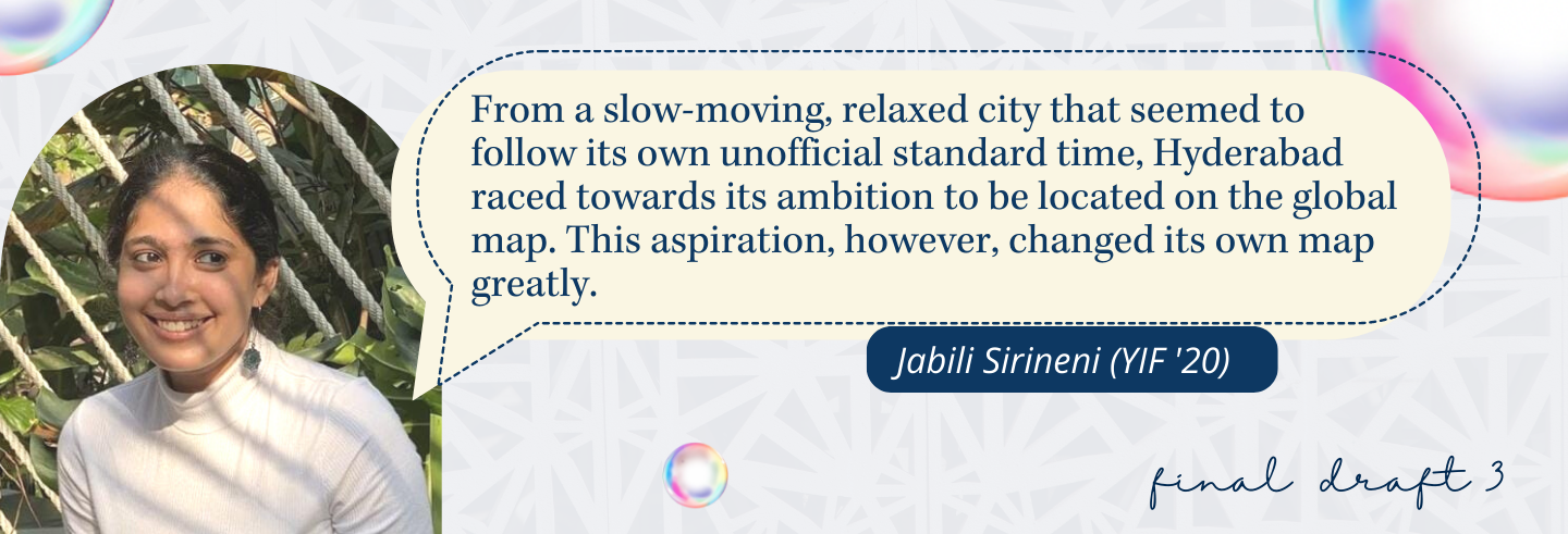
I have lived in the city of Hyderabad for the entirety of my life barring a brief period of two years from 2003. When I returned to the city with my family in 2005 after this brief interlude, the pace of the city had seemed confusing and chaotic. The traffic was denser and moved faster, new roads had appeared, entire villages around the HITEC City and other developing areas had been converted into residential neighbourhoods. Most of the single storeys in my neighbourhood had been replaced by tall glass buildings and alien architecture, and most of my neighbours had moved or were moving into high-rise apartments all around the city. From a slow-moving, relaxed city that seemed to follow its own unofficial standard time (which was at least half an hour later than any scheduled time), Hyderabad raced towards its ambition to be located on the global map. This aspiration, however, changed its own map greatly.
It was only years later, as an architecture student poring over large master plans of the city that I realised: what I remembered as a sudden unfamiliarity in my city of 2005 was part of a larger systemic change, and this change was guided by the master plan I was studying. During the course of such urban studies, I observed the inconsistencies between the master plan on paper and the existing condition of city spaces. One of my first observations was the solid division lines through the city drawn to split areas into their prescribed functionalities— Residential, Commercial, Industrial etc. This led me to understand the fundamental problems with the master plan—inflexibility, monotony, and detachment.
This paper is inspired by various such interactions with master plans and ethnographic studies in the city ever since. By taking Hyderabad as its prime case study, it aims to understand certain problems of the master plan and bring to light its failure in ensuring sustainable development and its insensitivity to existing local development models. Taking a cue from such models, the paper also aims to propose, through examples, new methodologies of development that may help in shaping cities better.
The Problems in the Master Plan
Typical master plans are complex and colourful, like cities, but unmoving and unchanging, very unlike cities. Master-planning exercises for cities are pursued with futuristic ideas that sometimes span 20–30 years. During such long periods, certain socio-economic changes take place in a city that are unanticipated by these master plans (Nallathiga 141). These shifts can’t be anticipated because cities are studied on a macro level by urban planners. Policies and boundaries are drawn out from this perspective and pose a risk to existing workable models—usually local interventions that emerge from regional problems—which are overlooked in the process. The site of such models is usually where administrative bodies do not aim to reach: from infant informal settlements by the sides of busy roads to notified slums, and from deteriorating heritage structures reclaimed by the public to saturated city centres.
The role of urban planners and planning bodies is to solve the problems of growing cities—planning for socioeconomic development, transit systems, sustainable development models, etc. within the city for its effective management. Through the examples of cities like Hyderabad, among others, we can observe that the focus of current master plans made by urban planners in India is on the creation of new commercial districts and residential neighbourhoods— without necessarily accounting for their future impact, although they claim to ‘plan’ for that very future—on an already deteriorating body. A close reading of the Hyderabad master plan for the year 2031 discloses the idea of ‘development’ it proposes for the future: a great emphasis on provision of Special Economic Zones (SEZs) to invite investments from different national and international industrial organisations; creation of ‘urban zones’ for commercial development; increase in city limits that could encroach into villages surrounding the city. The layout summary provides a brief understanding of the motives of this master plan—SEZ development, land pooling schemes, and township development (Hyderabad Metropolitan Development Authority).
This document demonstrates that master plans are prepared without leaving much space for flexibility. Such policies in a master plan are what can be termed ‘inadequate’, as they fail to meet the expectations of the citizens as well as the decision makers for several reasons—poorly implemented designs; simplistic understanding of public aspirations; ‘restrictive’ methods that ‘curb’ public interventions; inability to predict future trends and plan ahead; ignorance or negligence towards existing problems in the urban landscape (Nallathiga 141). The Hyderabad Master Plan 2031 in that sense is an inadequate one as it doesn’t include any problem-solving mechanisms to develop a people-centric model or an environmentally viable approach to city planning.
A G Krishna Menon writes in his paper titled, “Imagining the Indian City” about Indian town planners, “[Their] alienation from ground realities is clearly evident from the seemingly intractable problems which confront Indian cities. The logic of urban development appears to defy [their] will and imagination and it is commonly acknowledged that successive Master Plans are characterised more by violations than by observance” (2932). As Menon argues, Indian town planning has become an ‘uninspired mechanical exercise’ where planners are ‘low-level functionaries in the decision-making hierarchy of the government’. He laments that planners find it easier to adapt to new patterns but not to new ideas that define these patterns. Urban planners are detached from understanding the cultural and social nuances of Indian society, and therefore form only an image of a city that is influenced by Western models, however volatile they may be (2932). These Western models—criticised for having shortcomings themselves— when adopted (and not adapted) by Indian cities become unworkable due to contextual inconsistencies. One of the main aspects of this model that Indian town planning seems to have borrowed is that of creation of typical districts with uniform planning.
Jane Jacobs, in The Death and Life of Great American Cities, criticised this very aspect that has been an invariable influence for present-day planning, especially in India. She illustrates, through the example of Eighth Street in Greenwich Village, New York, how a locale can be successful for a period of time owing to its popular monotony but will eventually decay into a ‘has-been’ space when it reaches a saturation point where only a certain single type of function takes place. Eighth Street went from being a common nondescript street to a bustling locality with theatres, convenience stores, and nightclubs. Since the street was busy throughout the day and night, restaurants became very popular on Eighth Street owing to the high profit margin in that area. Eventually, the bookstores and galleries that formed the diversity of the street were ‘pushed out’ by new restaurants, and any other typology of uses stopped entering the street. The popularity of Eighth Street would slowly fade because of the disappearance of the very reason for its reputation. Jacobs further argues that such districts will not be able to grow with the rest of the city or evolve beyond this point. This saturation results in the centre of the city shifting to different places over time. She calls this phenomenon the ‘self-destruction of diversity’ (241–42).
In the name of ‘IT corridors’, most fast-growing Indian cities are witnessing this ‘self-destruction of diversity’. These are almost dystopic areas where only a singular type of building is constructed—offices for the Information Technology (IT) sector. Cities like Delhi NCR, Bangalore, and Hyderabad all boast the presence of these corridors. Although they are portrayed as market centres that aid in the development of the city, they are usually built upon demolished urban and rural areas and only allow for a single type of construction. The delineation of these districts into areas almost outside the city with a specific function makes them an isolated, faraway part of the whole. There is a possibility that these areas may become derelict in case of redundancy of their function, and the city may not be able to reuse them efficiently. Many IT companies are now working at half their capacity due to the COVID-19 pandemic, and some plan to enforce this as the norm in the future. This will result in large spaces remaining unused and most buildings remaining unoccupied. It becomes necessary to ask if these spaces will remain fit to be reused at all in such a scenario.
Homogenous planning as the one in such IT corridors is likely to block the scope of a locality to evolve owing to social, political, economic, and ecological changes, and may thus cause stagnation in the locality. This recent example proves that master plans can’t predict future trends. If master plans must be flexible, it is necessary that the ideas behind them be re-oriented.
Re-orientation of this kind must involve studying the city in a unique way and mapping it from a perspective that is indigenous and innovative. This may in turn create complex discourses in urban planning and lead to the discovery of new ideologies. It may also give access to people to develop their own locales in an unhindered way. Such spontaneous and organic development of a city is extremely critical in the present scenario where we are heading towards increasingly monocultural methodologies of planning that are largely top-down approaches and seldom answer the needs of the city.
To re-establish the ‘spirit of urban planning’ (Nallathiga), the idea of the master plan itself must be reinterpreted. To that end, the paper proposes re-imagining four broad changes. First, taking an approach that is not only top-down but also bottom- up. Through this approach, local bodies can collaborate with the public to come up with solutions for urban problems. Following this approach may fill the gaps that occur during the execution of urban plans by involving all stakeholders with equal capacity in the process of the ‘development’ of the city. Second, these approaches must be studied in detail during any master-planning exercise and implemented in areas where they can be remodelled. This may provide modules of ‘indigenous’ (Menon) solutions to some crucial street-level problems. Third, planners must distance themselves from any preconceived understanding of city planning and look for new approaches and develop new theories. By distancing themselves from previous methodologies, planners may be able to derive novel perspectives on city planning. Fourth, diversity, spontaneity, and flexibility must be given precedence over rigid organisation of city neighbourhoods. This may leave ample space for the city to grow unhindered and progress beyond rigid lines. Illustrated below are examples that provide evidence of successful approaches to problem-solving in some urban spaces that are usually ignored by master plans—slums, heritage, and abandoned spaces—that will emphasise the need for the afore-mentioned solutions.
Self-sufficient Slums
In master plans, most of these areas are denoted as informal ‘settlements’ and not in the formal ‘residential’ category. When there is a new area to be ‘developed’ in the name of housing crisis or commercial development, these are the areas that bear the brunt of eviction. These settlements become expendable in the larger master plan of the city, and their potential for providing unique, organic solutions is extinguished along with their existence.
However, there are some anomalies to this phenomenon. One such settlement is Kothawadi in Santa Cruz, Mumbai, where a small group of people who played cricket together decided to brainstorm over various ways to uplift their neighbourhood. One of the first problems they decided to tackle was hygiene and sanitation. In collaboration with Bombay Municipal Corporation and some local non-governmental organisations (NGOs), they succeeded in providing a clean community toilet for the neighbourhood. The toilet, however, didn’t just remain a toilet. The group formally founded an organisational body called the Triratna Prerana Mandal (TPM) and built their office and a computer lab atop the toilet. The centre soon became an educational space for the children and youth of the settlement. To empower women from the locality, a community kitchen was created in a derelict building in the slum which emerged as different women’s self-help groups (Shankar 25). TPM became not just a full-fledged NGO, but an inspiration for self-sustaining informal settlements.From a small group of local people, TPM evolved into a communitybody organisation and a residents’ association. Today it works in a range of localities to provide community-level sustainable solutions in the domains of education, environment, solid waste management, and women and child development.
The efficiency and success of this model is the simplicity of its form—a participatory process of identifying and solving local problems. This example shows the importance of identification of the needs of the people instead of provision of abstract models that don’t permeate to the street or neighbourhood level (Shankar 25). It highlights the necessity of looking into such areas to observe the various bottom-up approaches of development that exist. These models, when promoted by future master plans, can cause a paradigm shift in urban planning where simple, fast, cost-effective, and workable solutions can be implemented for the betterment of the city. These approaches will be people-centric as they are emerging from public issues.
While some models for ‘development’ don’t reach the settlements in question at all, some others that do reach are simply inefficient. In such cases of conflict, a fair level of interaction can be seen between the administrative bodies and the people. One such example is from one of my ethnographic studies of the Jubilee Hills slums in Hyderabad, which is one of the biggest notified slums in the city. The slum is located on a steep slope, and most parts of it are accessible only on foot. It is significant to note that its topography and location may be the main reason for its residents not being evicted. Furthermore, the reason for provision of basic amenities in the area is due to the major vote bank constituted by the dense population of this slum.
The people of this slum were provided with three options instead of evictions— lifetime ownership of the land on which their tent/gudisa/jhopdi stands; a half built house by the JNNURM1 scheme; a fully functional house under another government housing scheme. Contrary to preconceived speculations, most people chose to stay in the settlement in their kutcha dwellings. In fact, very few of them chose the half-built residences and further went on to build them with their own savings. Even fewer chose the government apartment blocks which now lie abandoned. Some of the residents recounted how the government apartments didn’t provide sufficient water supply and had faulty drainage and electricity systems. They found it easier to illegally draw water and electricity from the main supply and connect their drainpipes to the nearby lake. Not only do the people choose to auto-construct2 (Caldeira) large parts of their neighbourhoods but they also find solutions to pressing everyday problems like rainwater seepage and garbage collection.
This example illustrates how people in dense settlements negotiate their urban spaces and construct them by themselves. The general solutions that master plans provide—cleanliness drives, housing schemes—don’t work in these neighbourhoods since the master plan is itself inadequately aware of the prime aspects of these localities, let alone the nuances. Local solutions and methods are what aid in the settlements’ survival, in case they escape demolition.
Master plans will have to, therefore, take into account the issues, nuances, and necessities of the people who live in these spaces before providing unworkable schemes. They must also look to the local solutions to see if they may have the potential to serve other similar instances of urban population.
Reclaimed Heritage
“The survival and future of heritage are linked to urban and spatial planning, which takes into account the integrity of space and the cultural heritage in it” (Scitaroci 1).
Even though there is enough emphasis on master plans and other conservation proposals by administrative bodies towards heritage, the vital question to ask becomes: Are the proposals materialising into reality?
There are two such examples in Hyderabad that come to mind: The Osmania General Hospital, which was built by the last Nizam and was threatened with demolition multiple times by the government. Due to pressure from conservation organisations, this proposal was later rescinded; however, such dissent is not taken into consideration by public bodies when master plans are proposed, devoid of any concern for public heritage. The Hyderabad Metro Rail layout was planned to cut across one of the oldest markets of the city, Sultan Bazar. The shopkeepers in the market were compensated for the demolition of their shops, but the cultural and social fabric of Sultan Bazar is now frayed. The erstwhile pedestrian street is now overshadowed by large metro pillars. The 200-year-old heritage precinct is visually obstructed by the track built above the market street. In addition to this is the reduced public accessibility to these shops and the rift caused between the shopkeepers of Sultan Bazar and its neighbouring Badi Chowdi market due to events that are associated with the construction of the metro line.
It is shocking to note that such insensitivity is similar in a city that is world-famous for its heritage–Agra. This example is inspired from a series of design solutions proposed by a Harvard classroom for the conservation of both the ignored heritage structures and the River Yamuna. While it is not necessary to delve deeply into the details of these academic design proposals for the paper, the process of their study reveals a crucial aspect. The students visited different parts of the city and interacted with communities that live in the shadow of the monuments. Their major observations were twofold: larger monuments were preserved and the people who live around them neglected; while smaller monuments were entirely ignored. Following this, the students proposed a range of solutions for different parts of the city. Broadly the solutions were based around delineating a 6-km-long Special Planning Zone for the 45 monuments and the Yamuna, and the creation of a governing body to act as a ‘unifying platform and facilitator’ between all the stakeholders (Mehrotra 42).
This approach demonstrates that there is indeed a possibility of creating such solutions where participatory models which engage with both the public and the administration can be formulated for overall urban development. The fact that a delineated urban zone was proposed shows both the inadequacy of the existing master plan and the prospect for a more nuanced approach through subsequent master plans.
Integrated Abandoned Spaces
There are many spaces in cities that eventually become derelict and are abandoned. Underused alleys, dead ends, and old factories are some examples. Once their original function or necessity ceases to exist, they gradually deteriorate and become obscure. This obscurity creates, in some cases, unused and unsafe spaces in cities. There is no social interaction in these spaces and therefore the public space deteriorates. This wasted space breaks the continuity of the urban fabric and creates ‘meaningless unstructured landscapes’ (Sameeh, Gabr, Aly 181).
Since master plans don’t study cities in detail as mentioned earlier in the paper, such places become more and more indistinct and are no longer part of the active city. There are some innovative examples where these spaces have been recovered. Such is the story of Gem Cinema in Kolkata, which was abandoned after a fire many decades ago. Gem Cinema, which had screened films like Sholay in the past, had turned into a ‘giant, grotty concrete box with blackened walls’ (Das). Recently, this part of a crowded urban neighbourhood was picked for the site of a visual arts exhibition by the CIMA (Centre of International Modern Art) gallery. The decayed look of the space was an apt backdrop for the artworks that were presented. Therefore, the space was repurposed by reworking electricity and basic infrastructure but keeping its derelict look as it was. The chairs were removed to create a large walkable space for the gallery, and the screen was replaced by artworks. One of the artworks that hangs in the gallery is an ode to the loss of the erstwhile theatre in ‘public memory’ and on the city map (Das). The main aim of this repurposing was to rekindle not only the memory of this once-famous public space, but also the materiality of the public space itself.
Reviving a lost public space by altering its activity and reimagining its potential is the inspiring element of this story. In cities, there are many old public spaces that are abandoned and unused. In a developing city, there is always a crisis for housing, the need for more institutional and public buildings. If such prospects are encouraged by master plans by delineating areas that are inactive and up for re-use, they can be reimagined in such ways and made part of the city’s sustainable development.
Conclusion
By studying lapses in the master plan through ethnographic studies and urban research, and by citing examples of three typologies of spaces, this paper has proposed a re-orientation of the master plan across three significant elements of the document. Each of these are inventive forms of development that utilise the existing potential of a city as opposed to looking outward to integrate more land and people into its boundaries. These approaches will therefore help to re-activate the core of the city without external interventions but through self-sustained measures.
Master plans may not have the capacity to delve deeply into the nuances of spaces. However, it is imperative that planners remain aware of the evolution that happens in streets and neighbourhoods without their intervention. It is necessary that these approaches are considered with sensitivity and integrated into the planning mechanisms of a city in a manner that is not forced or rigidly prescriptive. The most necessary approach to planning is that people and the systemic workings of the city they inhabit are not unfamiliar to each other, as from this unfamiliarity comes monotony and eventual decay.
By employing these new approaches to planning, urban planners may become crucial promoters of an urban change that provides a fresh understanding of the cityscape, people-centric solutions for the social space, and a ‘self-referential’ framework for the planning and design of future heterogenous cities. This, perhaps will lead us to what Quli’s couplet was really about—a prospering, active, moving city.
About the Author:
Jabili Nellutla-Sirineni is a poet and architect (strictly in that order) from Hyderabad. Being surrounded by books from a very young age, she naturally took a deep interest in words. As a socially awkward child, she discovered joy and freedom in writing her thoughts instead of speaking. She loves to observe and draw insects and paint watercolours. Living almost all her life in Hyderabad, she was constantly fascinated by its stories, people, and streets, and its transformation over the period of her life. As part of the critical writing programme at YIF, she was able to bring together her love of writing and her longing for a constantly evolving city. After ardently scrawling question after question in the nascent drafts of her final paper, Jabili deduced that critical writing is not just about questions, but also answers (well, after a number of comments from her preceptor). This paper was then carefully woven together, with glimpses of the city she loves, snippets from some other cities, and more answers than questions.
About YIF CW Programme:
The YIF Critical Writing programme is a unique, one of a kind opportunity for Fellows to hone their critical thinking and writing skills under the able supervision of trained experts in the field. The CW programme employs a constantly evolving pedagogy, making learning and knowledge production more collaborative and dialogic. Preceptors at the YIF CW programme teach writing through a range of topics including but not limited to ‘History, Philosophy, and Anthropology of Science’, ‘Politics of Language and Multilingualism’, and ‘Education, Literacy, and Justice’.
About Final Draft:
The Final Draft is the annual journal of the YIF Critical Writing programme. It showcases the range in topic and genre, as well as the strength of writing in the highly diverse YIF student body. These pieces of writing, submitted by Fellows from various classes of the YIF represent only a small fraction of the variety and range of writing done over the years.
About our campaign:
Through our ‘Final Draft 3’ campaign, we hope to give you a glimpse into some of the styles and voices that have evolved, the concerns and ideas that fellows have explored and the seriousness of their engagement with writing as drafts in motion; searching for meaning and connection, which makes this more of a pedagogic exercise book.
(This piece was first published in the Final Draft, A Journal of the YIF Critical Writing Programme.)