


Foray into the forest: Bandhavgarh National Park and its Archaeology
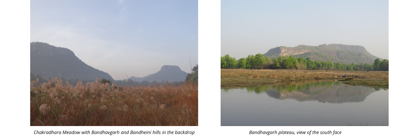
Bandhavgarh National Park is known for its lush biodiversity and its famed resident- the Royal Bengal tiger, and for that reason, is one of the crown jewels of Madhya Pradesh. With a core area of 105 sq. km and a buffer area of about 400 sq. km, it was declared a national park in 1968 and became a tiger reserve in 1993. The Tala segment of Bandhavgarh, the locale of our archaeological exploration, is a tapestry of two high forest clad hills Bandhavgarh and Bandheini, among stretches of flatlands with extensive meadows. The Bandhavgarh hill dominates the landscape with its rectangular plateau on the summit marked by a medieval hill-fort giving it the name. The forest here is a moist tropical deciduous one, dominated by Sal trees, bamboo clumps, and other varieties ranging from woody ficus to the gnarly Indian frankincense.
Tigers and leopards coexist in the jungle with deer, wild boar, langurs, reptiles and termites and some 250 species of birds. Bandhavgarh’s wildlife has been the subject of many works such as Hashim Tyabji (birds), Kay Hassall and Satyendra Tiwari (butterflies) and Iain Green’s work on the majestic big cat of the forest. However, the archaeological importance of the area in terms of its topography and jungles, remains largely unexamined.
What We Did
To map and document the archaeological remains, and analyze human interaction with their natural environment from a historical perspective, a team was put together – spearheaded by Nayanjot Lahiri, Professor of History at Ashoka University and assisted by Debdutta Sanyal and Samayita Banerjee, Ph.D Candidates at the Department of History, Ashoka University, Dr. M. B. Rajani, Professor at NIAS Bangalore and Satyendra Tiwari, wildlife photographer and naturalist from Bandhavgarh. On the field, we were assisted by Chote Singh, Chhote Singh, Nanku Baiga and Suresh Dwivedi, forest guards without whose help and knowledge, none of this would have been possible. Our fieldwork was done over four seasons (March 2021, November-December 2021, March-April 2022 and June 22), during which, through the lens of archaeology, we have investigated material relics and what these reveals about the patterns of occupation in a segment of Bandhavgarh’s forests. During our treks, a range of data was recorded on GPS devices, ranging from cartographic details to tracks. Later, this was combined with an analysis of satellite imagery of the terrain in general and the sites in particular .
What We Found
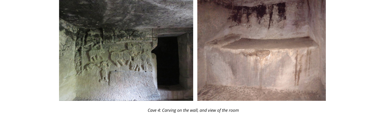
Rock cut Cave Shelters
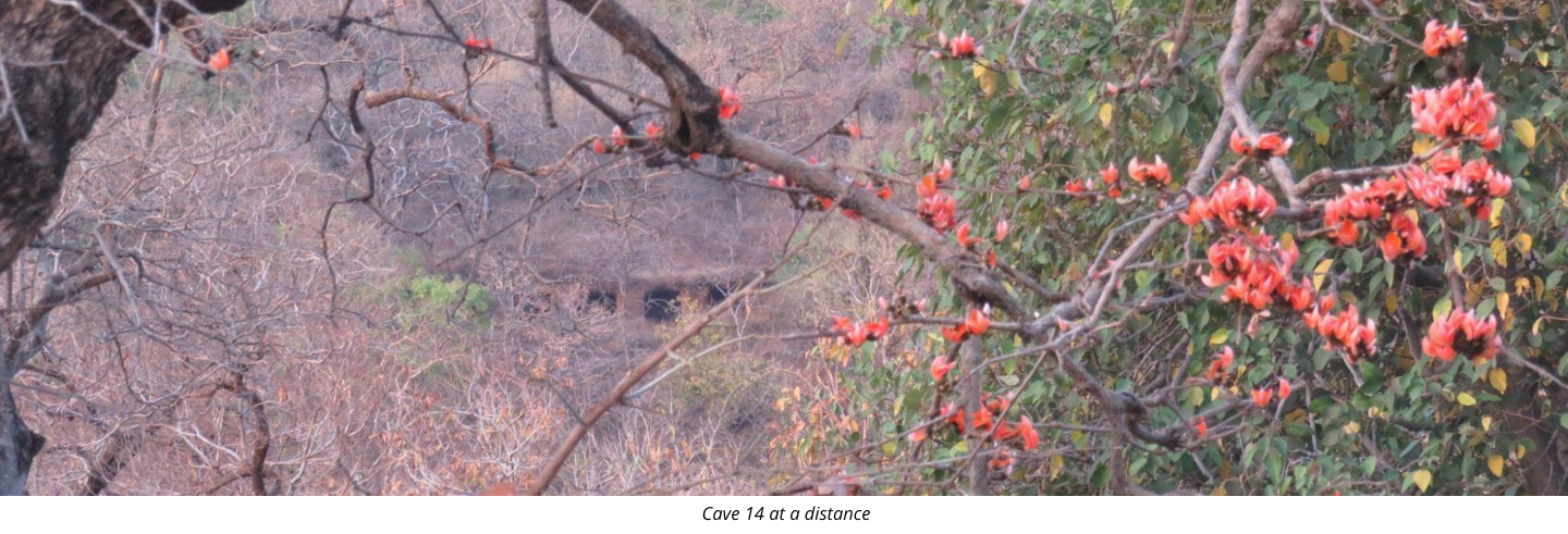
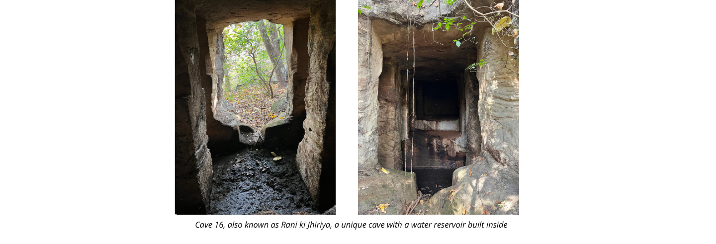
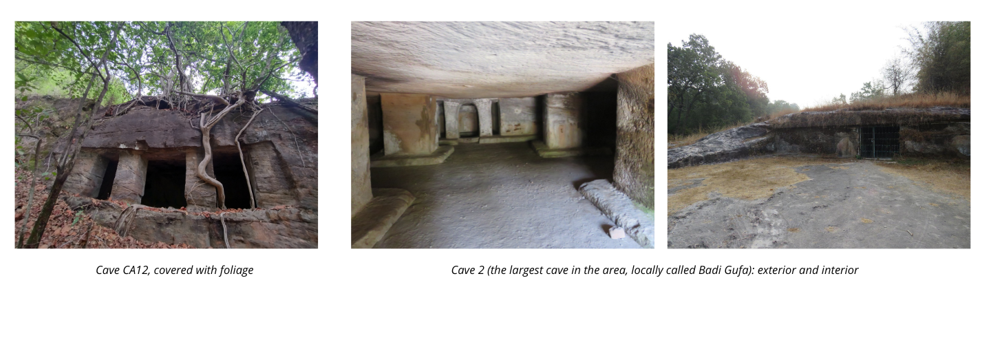
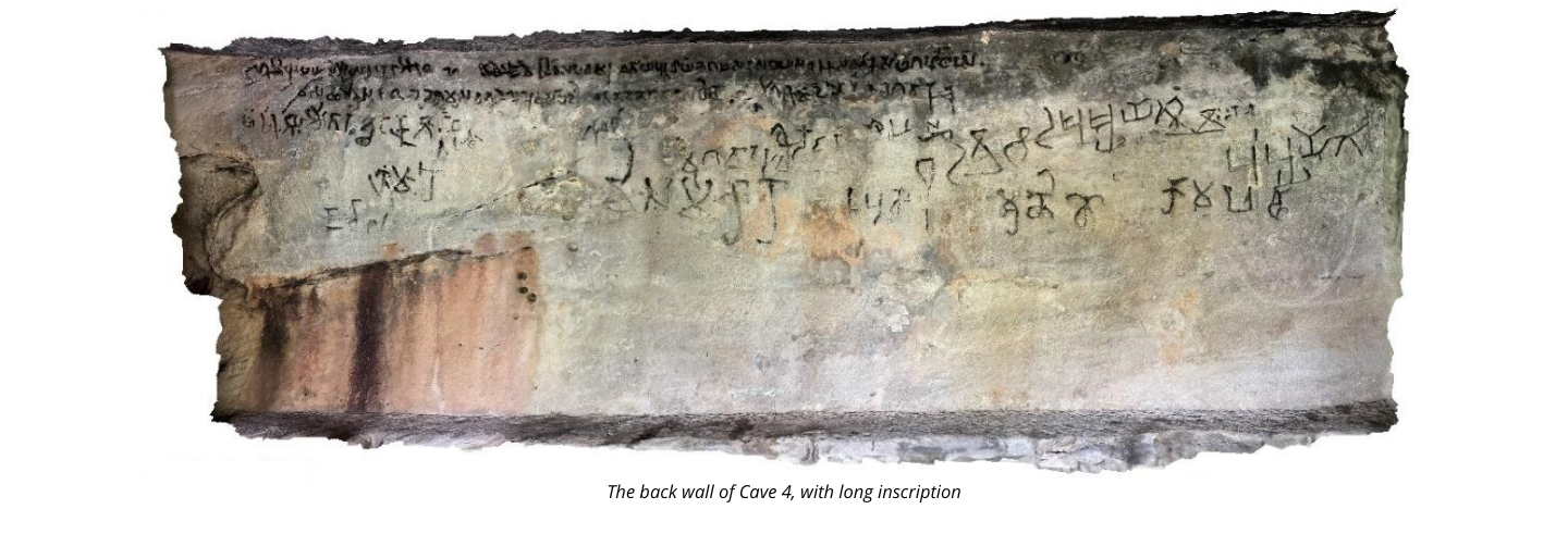
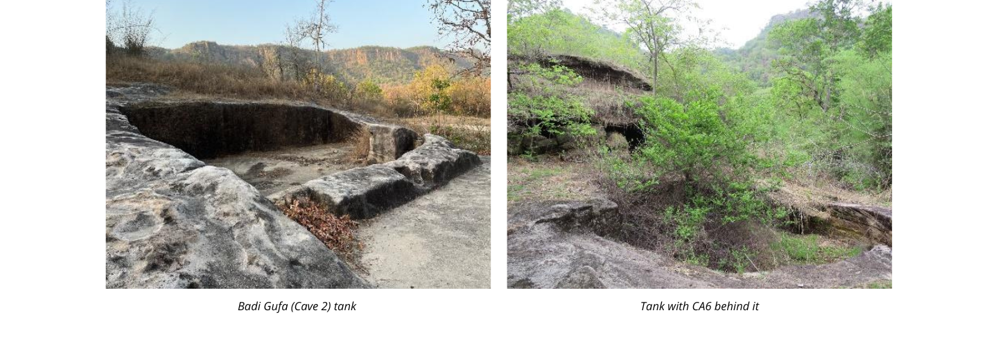
About 81 rock-cut shelters were located by us in an area of 5 kilometres – as the crow flies. The distances on foot and by forest tracks, though, makes the area where these are found, somewhat larger, covering some 8 to 10 kilometres. Of these, 44 caves bear numbers of the Forest Department while 37 caves are unnumbered. About 26 caves have inscriptions, with a few of them having more than one epigraph. A few also had carvings in their interiors and occasionally, on the cave exterior. While cave shelters could not be spotted in aerial imagery due to their locations and structures, the satellite photographs provided a bird’s eye view of cave locations in terms of the terrain and elevations. The caves were created on the north side of the Bandhavgarh hill and along several of the smaller hills in its vicinity there. The caves can be dated to the 2nd Century CE as can be gleaned from the inscriptions etched on their walls. These inscriptions, written in Brahmi script, in the Prakrit language, also tell us that they were built as resting spaces for merchants and traders. Some even had a tank or a well attached to them. The shelters are of various types. While some have long halls with a rock-cut bench running along the sides, some are small cubicle like rooms with one small entrance. Some caves come with a separate side room, with or without a rock-cut bed for the itinerants to rest on. Other types of shelters include front-open porches, and large multi-pillared halls.
Temples on and around Bandhavgarh Hill
In the 8th century CE, a political presence in the form of the Kalachuri dynasty appeared in Bandhavgarh. The Kalachuri rulers were based in Tripuri and ruled over a large kingdom that included Bundelkhand, Baghelkhand, Sagar and Jabalpur districts in Madhya Pradesh and the central section of Uttar Pradesh. The foundations of their power go back to the 7th century, and they continued to rule till the 13th century. Bandhavgarh first encounters the Kalachuris around the 8th century and with them a Hindu religious landscape now comes into view here.
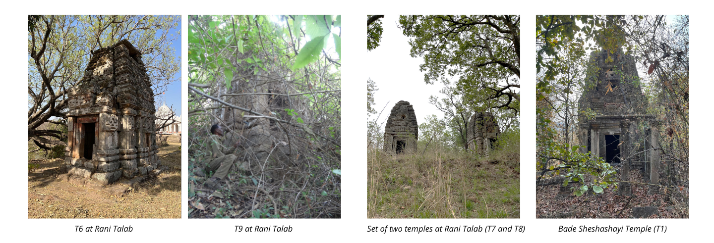
The Kalachuri temples are found across a varied terrain. There are several on the top of the Bandhavgarh hill, others high on its flanks and several closer to and in the vicinity of meadows. Additionally, what are marked as structural remains on the maps are also, in most instances, the remains of Kalachuri temples. The temples form the first major architectural intervention on the crowning area of the hill, erected close to each other and on the northern edge of the plateau.
Vishnu and his avataras
A couple of centuries after the creation of temples, a minister added on an entirely new architectural configuration. His name was Gollaka, the son of a minister called Bhanu, and he himself served King Yuvarajadeva (I). These facts figure in four inscriptions that he got inscribed there, in order to highlight his own familial lineage and his position in the court of the king. The short epigraphs were placed close to a dramatic in situ sculptural series that Gollaka got carved out around Vishnu and three of his avataras – Varaha, Matsya and Kashyapa.
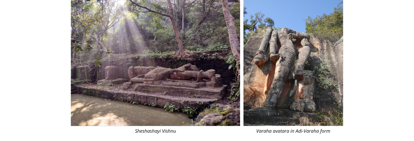
The images were spread out across higher reaches of the hill and on the plateau itself. The most spectacular of these was a reclining Vishnu in the form of Narayana, his eyes closed and looking as if he was in deep sleep with his feet towards a water channel that drips down water all year round. This collects in a pool where Vishnu is sleeping on the primordial serpent or Sheshanaga. Some 35 feet long, Vishnu himself is on a platform, and when brimming with water during the rains, it would appear as if he was floating on a bed of water, symbolic of the ocean on which the serpent is supposed to lie. It is only fitting that today, the stream near Vishnu’s feet is called the Charanganga.
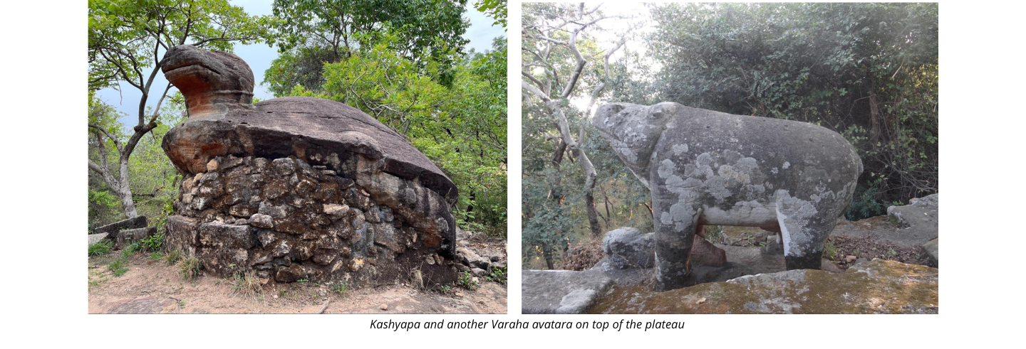
Beyond the ridge and some 200 m above it, three massive images were carved through the patronage of Gollaka – all belonging to the family of Vishnu. These were three of his avataras – Varaha which was very close to the plateau top while Matsya and Kashyapa/Kurma graced the northern slope of the plateau. These large in situ images were carved out of the sandstone and like the sleeping Vishnu, had identifying epigraphs.
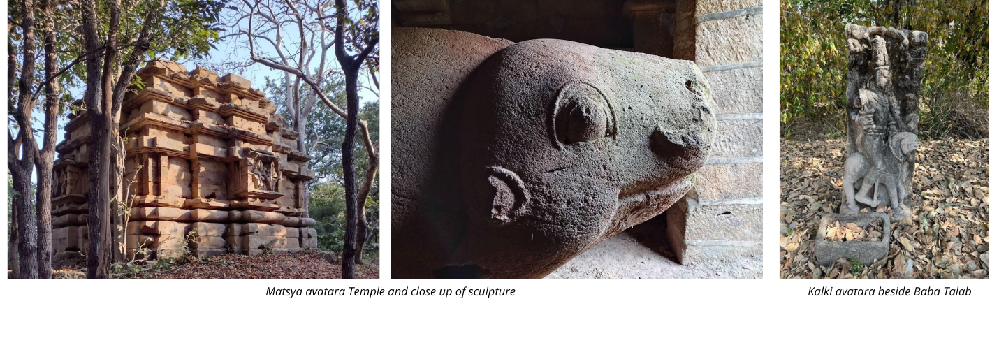
There are also portable images of Kalachuri times (several of which today have been placed in an open enclosure near the Kashyapa image), of which the most striking is that of Kalki on a horse, near the road that runs parallel to Baba Talab.
Layers of time
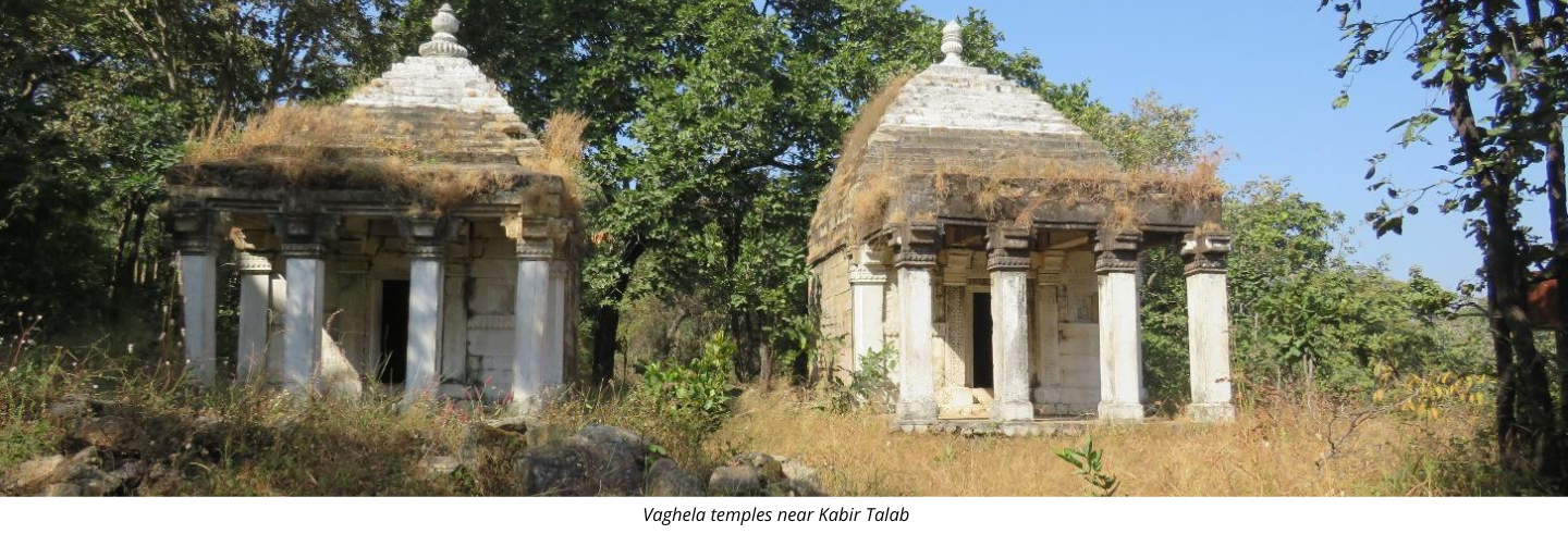
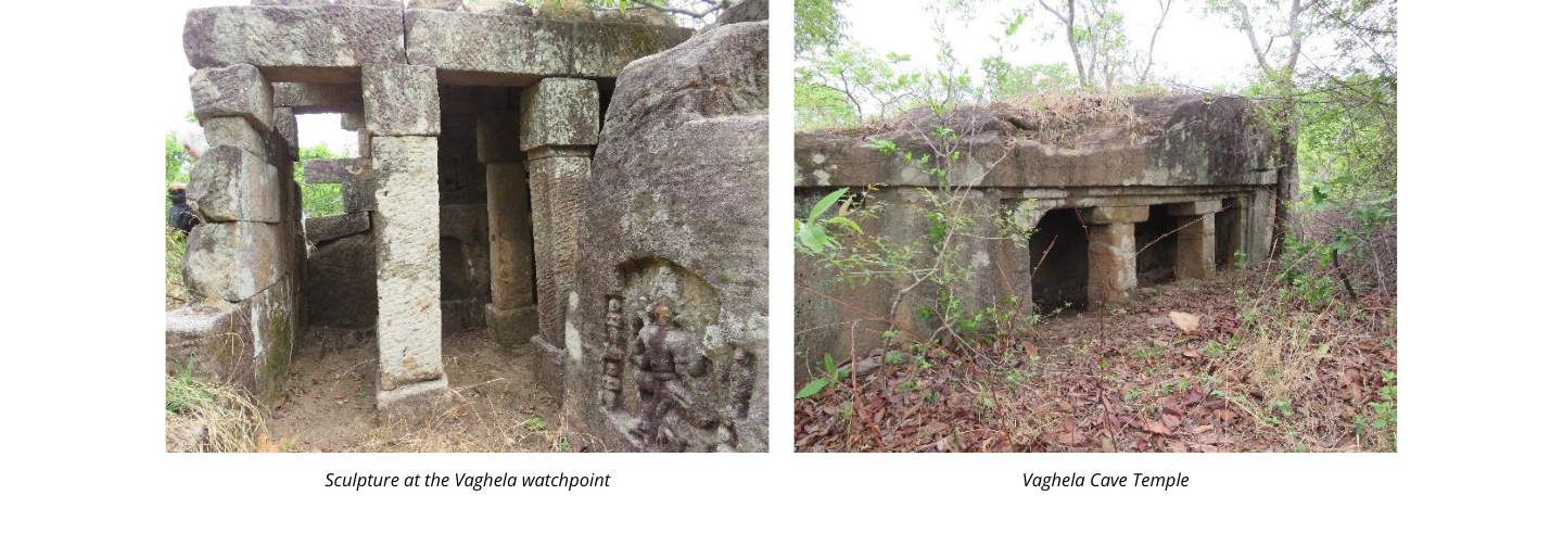
Although our study mostly focused on the early-historic and Kalachuri period remains on and around the plateau, we encountered a number of Vaghela period monuments, which range from temples, royal residential complexes and tanks to watch-points and worksites at the top of the plateau. Layers of time come together here as some Vaghela period temples get worshipped now as Kabir Mandir, while some others house broken pieces of Kalachuri sculptures, kept by the locals. This is absolutely not a modern practice. Just as some of the early historic cave shelters were retrofitted by the Kalachuris, the Vaghelas chose to build at sites that already had a Kalachuri presence.
Around the Meadows and villages
If the focus of temples and images was the northern part of the Bandhavgarh hill and plateau, there were others that came up around the meadows. these are the stones and architectural members that originally made up such structures and can be found in the meadows of Rajbehra, Sehra in the midst of a forested patch, and at Siddhbaba. near the Chakradhara meadow.
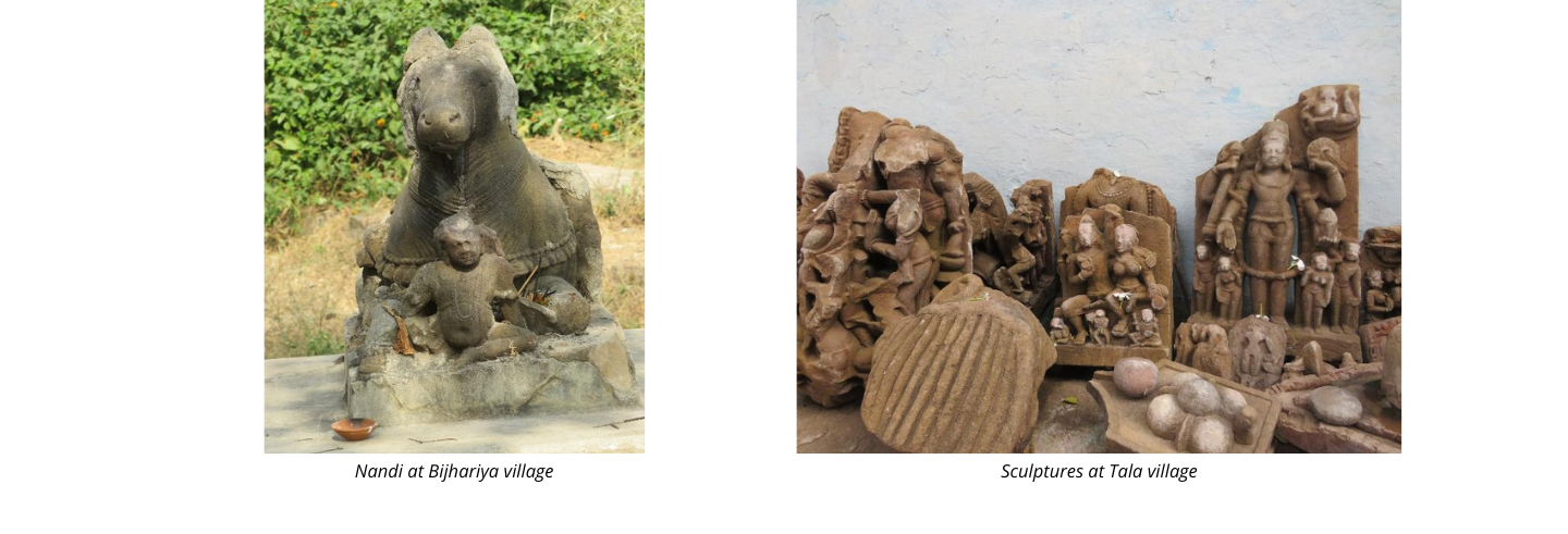
Apart from the meadows, there are villages very close to the Bandhavgarh reserve where stunning sculptural bricolage of Kalachuri times can be found – villages like Tala and Bijhariya, which have a thriving settlement during the present time.
What We Experienced
Along with the historical remains what we experienced was a stunning landscape and a spectacular range of wildlife. The Bandhavgarh National Park has a jeep trail that is made for the visitors who are otherwise not allowed on foot or any other transport. Since we had been given permission to explore the forest on foot to conduct our survey we had the opportunity to go to those parts that only the people in charge of the forest and wildlife has access to.
‘Our’ Serpent Eagle
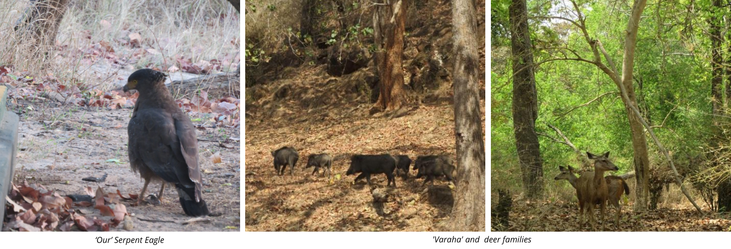
During our summer field visit in the months of March-April 2022 we would encounter a very stoic Serpent Eagle waiting by the structural remain at Siddhbaba looking around for food almost everyday. This serpent eagle became our lucky charm given the large amount of data we collected during that visit!
‘Varaha’ and deer families
During our rounds around the park we would come across families of wild boars and deer grazing and grunting away in all shapes and sizes. We would look forward to seeing them and have taken more photographs of them than our cameras could hold. The spotted deer and the occasional sambar were a pleasant sight to the eyes every time and the wild boars in their large numbers would just add on to our personal joke of finding a modern day “Varaha” presence in the park.
Butterflies and Birds
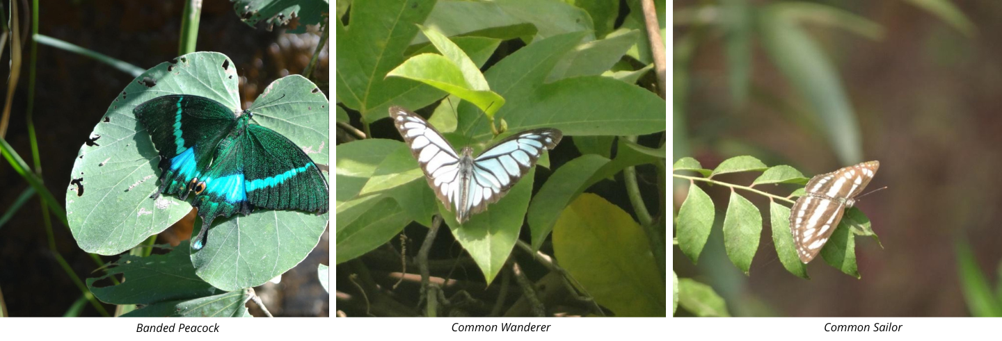
The very first day of our winter visit was marked by the sighting of a beautiful Banded Peacock Butterfly (left). During our stay in Bandhavgarh we saw a great many variety of butterflies such as the Common Wanderer, Common Crow, Common Gull, Common Emigrant, Lemon Pansy, Chocolate Pansy, Plain Tiger, Danaid Eggfly and the Baronet.
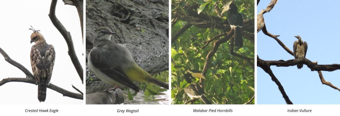
We also saw a range of birds such as the Serpent Eagle, Crested Hawk Eagle, the Lesser Adjutant Stork, Malabar Hornbill, Grey Hornbill, Egyptian vulture, Fishing Owl, Grey Wagtails, Common Bee-eaters along with several Coucals and Jungle Babblers.
Skull-ridden path
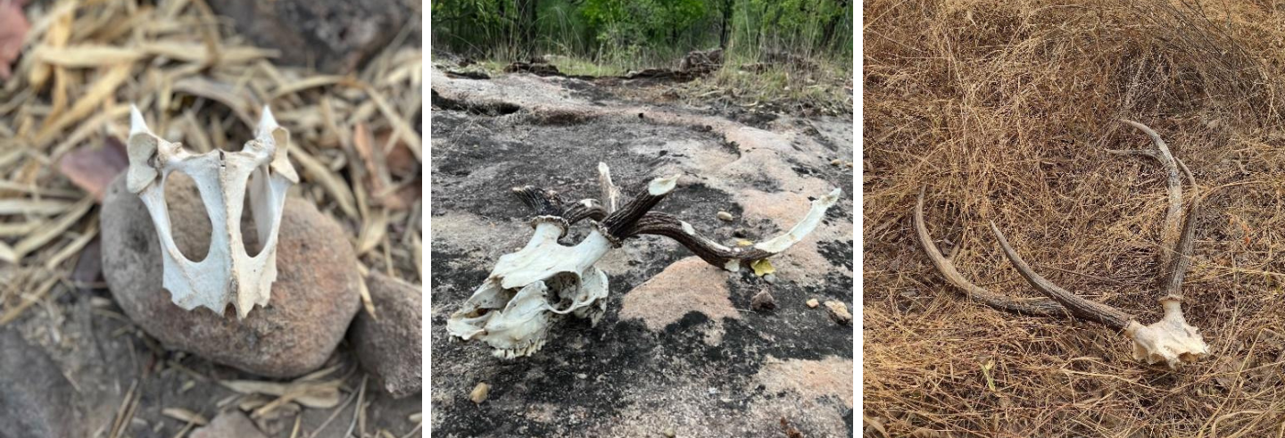
One of the more exciting part of our walks in the forest was finding skulls and bone remains of animals that were either eaten by predators or had died naturally. We had found skulls of spotted deer, sambar and even of a freshly-eaten langur. Along with these we also found broken antlers and tusks of wild boar in the cave shelters. These added a dash of goosebumps to our already excited nerves!
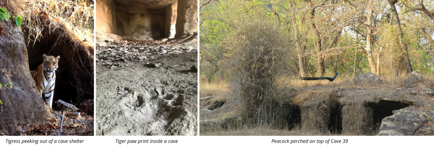
Caves and its present occupants
Ancient cave shelters were still very much in use! In many caves that we visited we would find proof of habitation. These occupants would leave bones and teeth and porcupine quills to leave us a clue about their identity. Even though we were not lucky (or unlucky!) enough to meet them in person during our visits, Mr. Tiwari has given us some incredible photographs that he had taken earlier from the back of elephants.
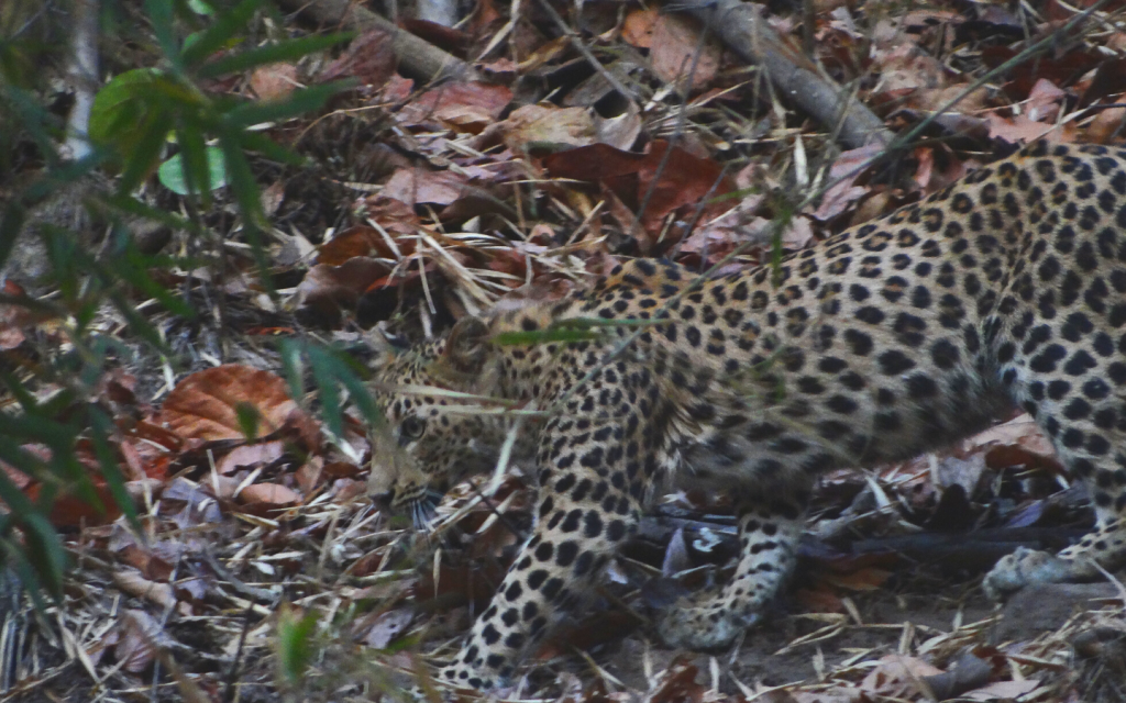
Leopard sighting
Leopards are generally elusive creatures as the likes of Jim Corbett and Kenneth Anderson would tell us, so when we had the experience of seeing a leopard cub in April 2022 we simply couldn’t believe our luck! This leopard stayed and even posed for a while we couldn’t take our eyes and cameras off of it.
Graced by the VIP
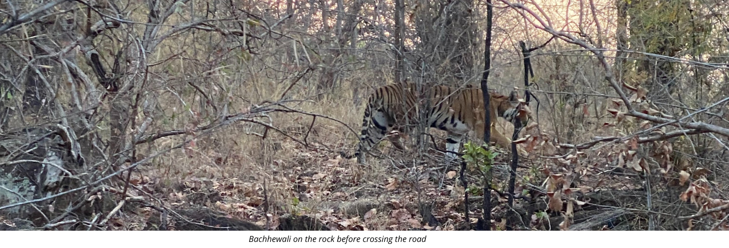
Most people visit the Bandhavgarh National Park to see the striped big-cats and they usually are successful. One day, we were taking a detour to check if there were elephants around and if we would be able to get off the jeep to do our work. Suddenly, our driver Santosh, slowed the jeep and asked us to look to our left. There she was, casually sitting on a rock. Bachhewali, as the forest guards fondly called her, gently stretched after seeing us before crossing the road and disappearing into the forest.
Maps Showing the Spatial Distribution of Archaeological Remains
Below are the maps we have made that shows the distribution and concentration of sites and remains in and around the Bandhavgarh National Park. These are created on Google Earth and on QGIS software. These maps give an idea of the entire study area including the nearby villages (fig 1), the spatial distribution of cave shelters to the north of the plateau (fig 2), a DEM or Digital Elevation Map showing the height and contours of the cave locations (fig 3), Kalachuri remains (fig 4 and 5), Vaghela remains (fig 6) and waterbodies (fig 7).
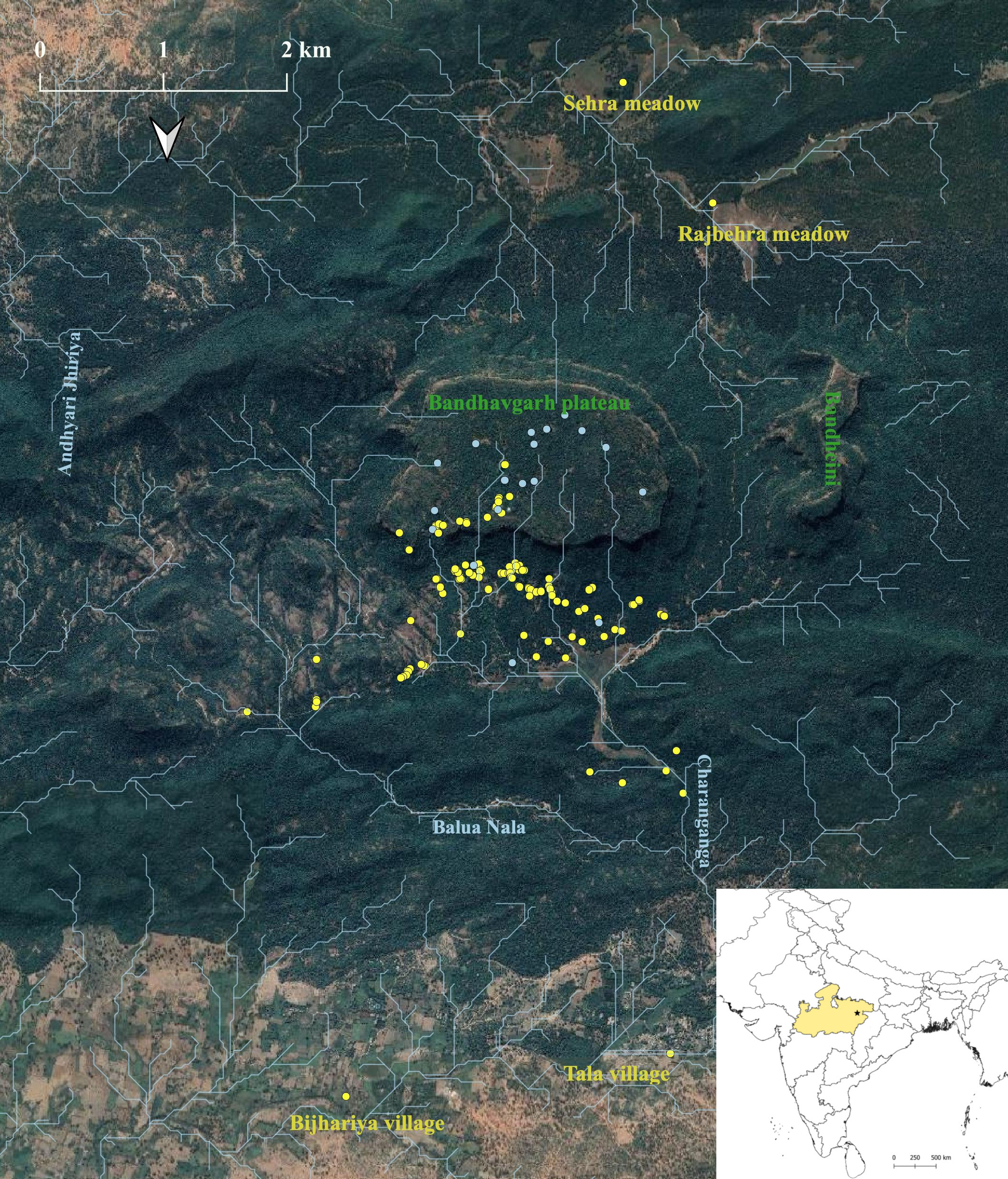
Figure 1: Map showing study area
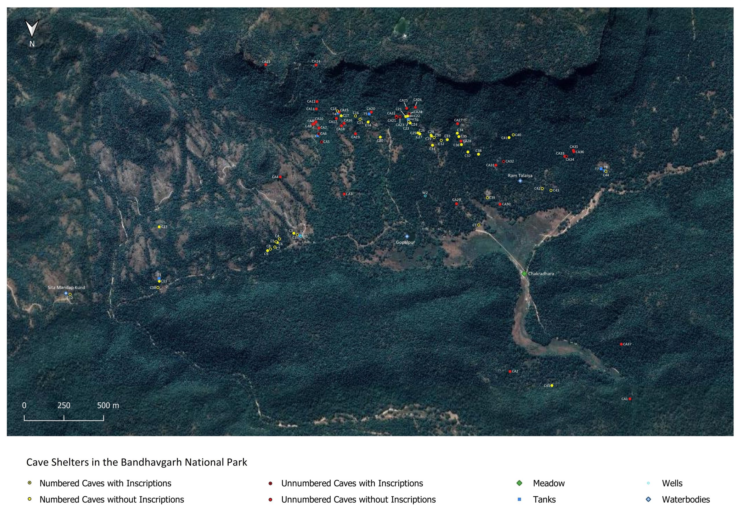
Figure 2: Cave shelters and their spatial distribution
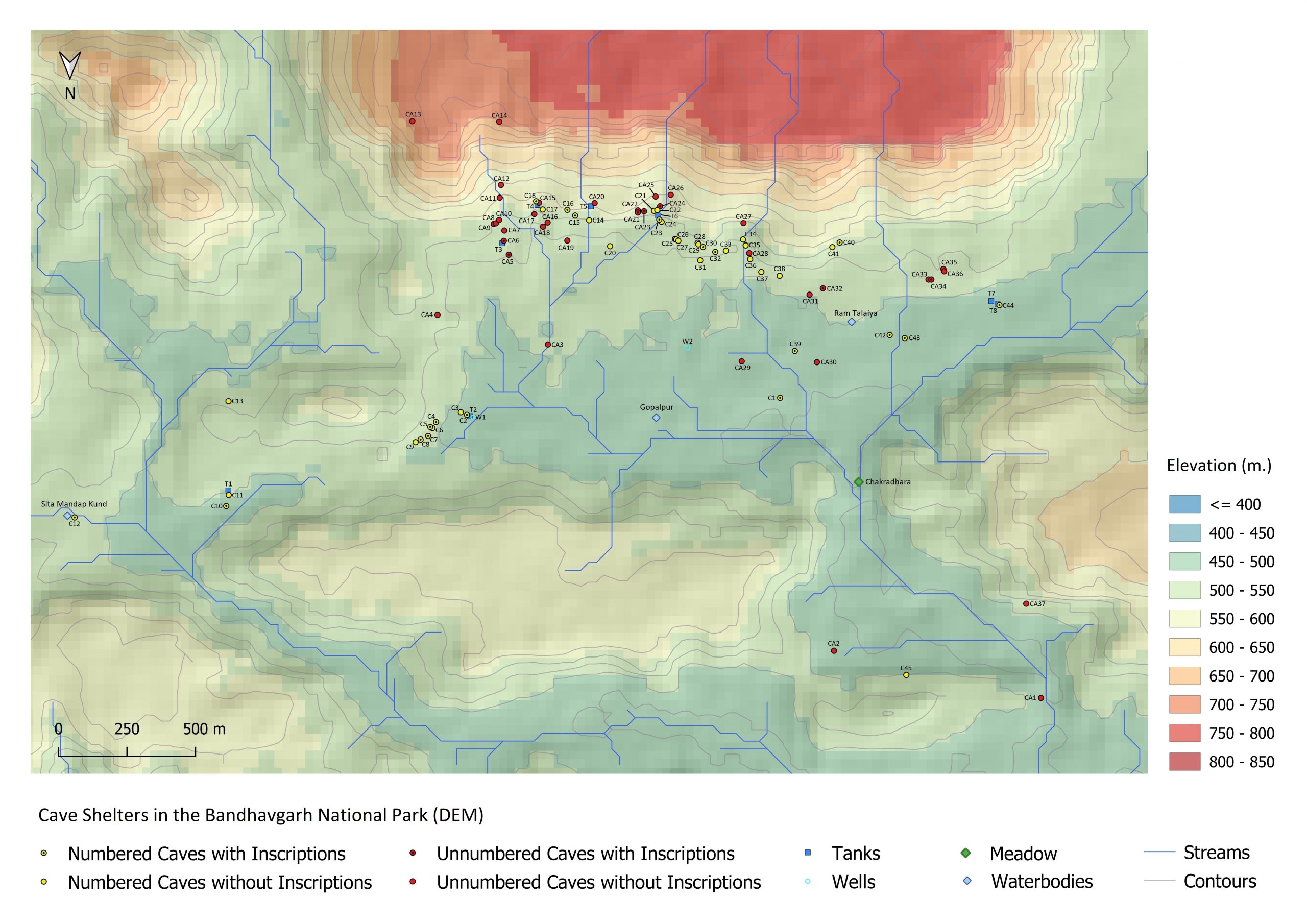
Figure 3: Digital Elevation Model of cave shelters
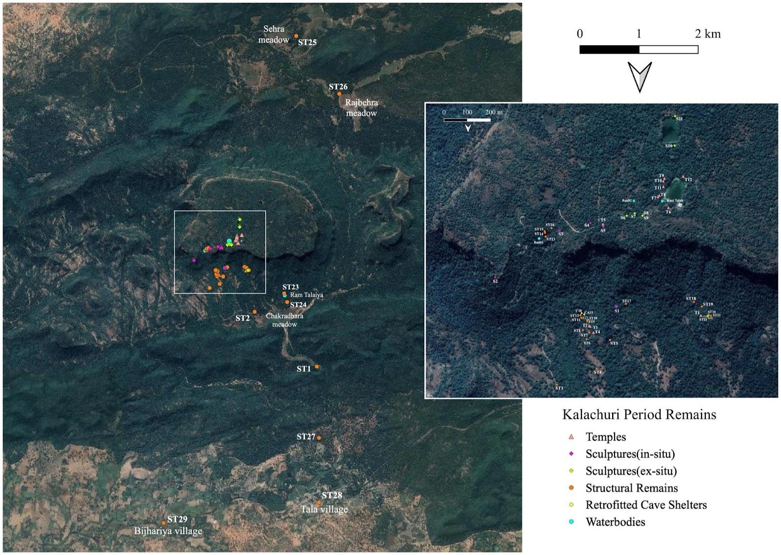
Figure 4: Kalachuri Remains in the Bandhavgarh National Park and adjoining villages
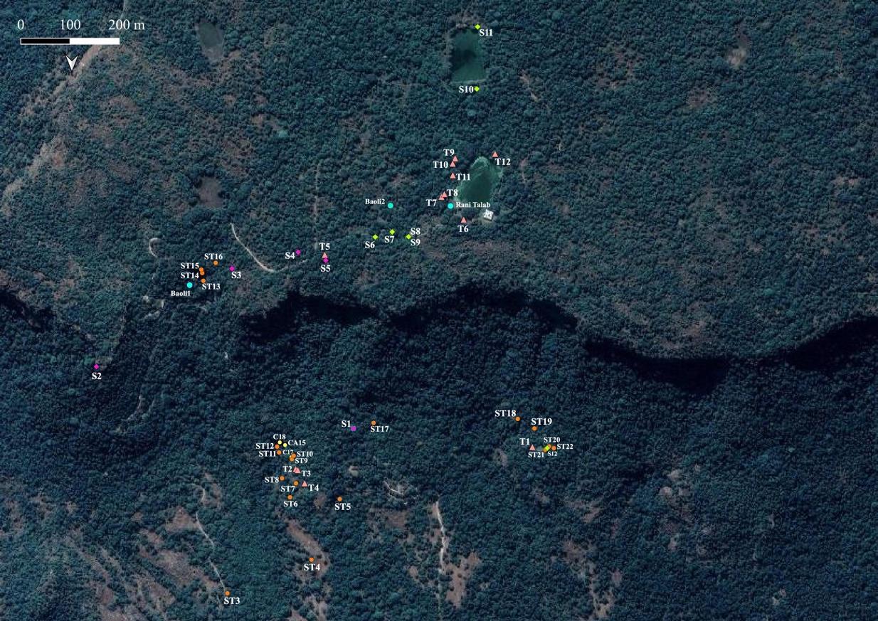
Figure 5: Concentration of Kalachuri period remains on and below the Bandhavgarh hill
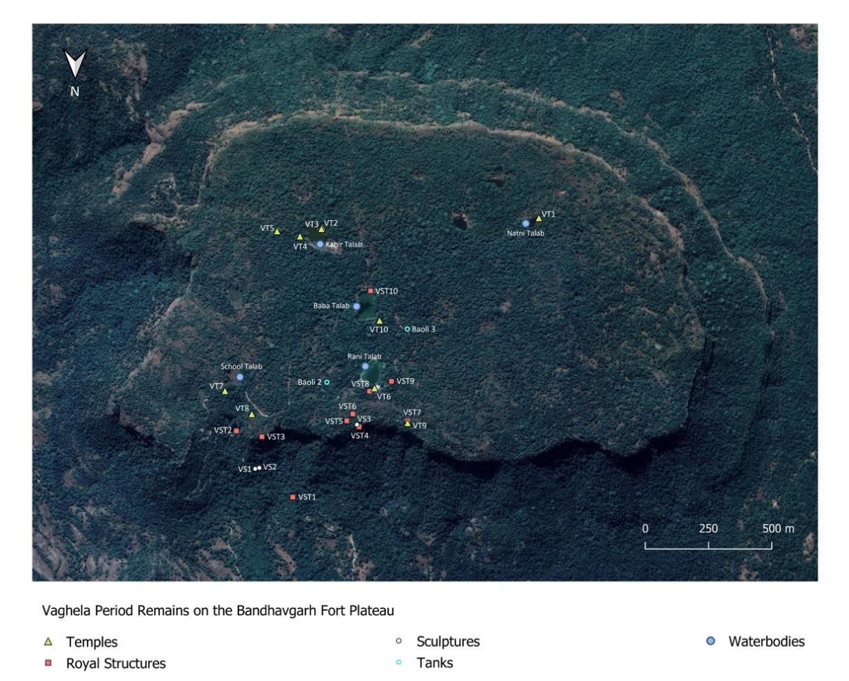
Fig 6: Vaghela remains on the Bandhavgarh hill
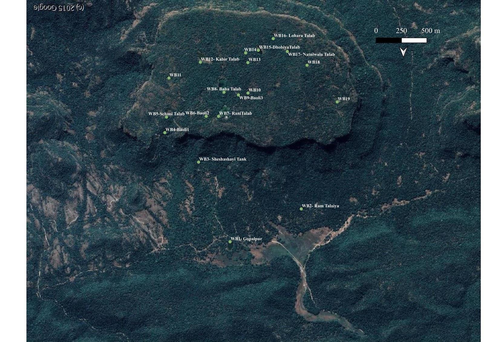
Figure 7: Waterbodies inside the Bandhavgarh National Park
Our Team
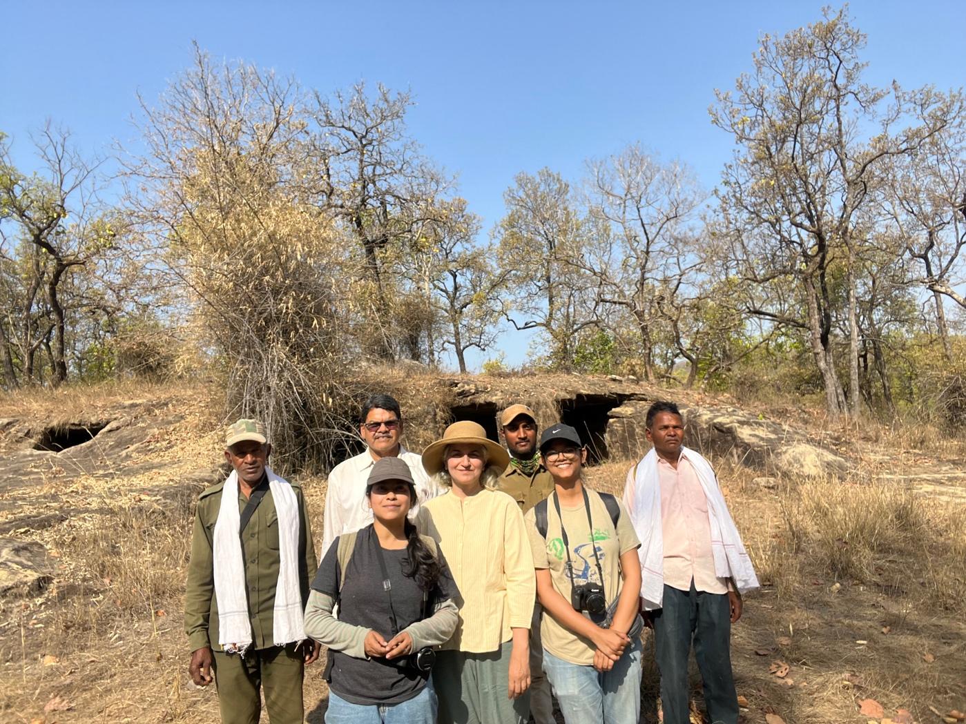
Group photograph taken in front of Cave 39 at Ram Talaiya
(left to right) Chote Singh, Satyendra Tiwari, Samayita Banerjee, Professor Nayanjot Lahiri, Santosh Yadav, Debdutta Sanyal and Chhote Singh